
Review · LAS VEGAS
Las Vegas Day Trips: 3-Day Self-Guided Audio Tour
The best thing about this Las Vegas experience is its freedom. Instead of squeezing Hoover Dam, Red Rock Canyon, and Death Valley into one rushed coach trip, you can spread them across three days and stop only where you want. GPS-triggered audio plays as you drive, adding stories, directions, music, and practical tips without requiring a live guide.
I especially like the one-price-per-group setup, which costs $13.59 for up to 15 people, and the offline map that keeps working without Wi-Fi or mobile data. The main thing to consider is that you provide the car, fuel, meals, parking, and entrance fees, and you must manage desert heat, long drives, road conditions, and reservations yourself.
Key things to know before you go
- Three major day trips in one app: Cover Hoover Dam and Lake Mead, Red Rock Canyon, and Death Valley over roughly three days.
- Private and flexible: Start, pause, skip stops, or return to a favorite place with only your own group in the vehicle.
- Strong value for groups: The $13.59 price covers up to 15 people, not each individual passenger.
- Offline navigation: Download the tour over strong Wi-Fi before leaving, then use GPS directions and audio without data.
- Hiking is part of the experience: The route includes easy walks, longer trails, steep paths, and strenuous canyon hikes.
- Desert planning matters: Water, timing, road checks, and fuel stops are essential, especially for Death Valley.
Three big day trips without a fixed schedule
This is not a conventional guided excursion with a bus, departure time, or guide riding beside you. It is a downloadable Shaka Guide experience that turns your own vehicle into a private touring setup.
The app offers three routes, each with GPS-based narration and turn-by-turn directions. You can follow the suggested path, pause for lunch, skip a hike, or spend longer at a place that catches your eye. The tours never expire, so you are not locked into using every route during one visit.
That flexibility is the real product. If your group includes hikers, photographers, children, history fans, and people who mainly want scenic drives, you can divide the day without forcing everyone into the same pace.
The low price is also worth examining. At $13.59 for a group of up to 15, the cost per person drops sharply when several people share one car. It is less useful for someone who wants transportation or a fully hosted day, since the tour does not provide a vehicle, meals, refreshments, parking, or attraction admission.
More Self-Guided Audio Tours in the USA
- Gettysburg Battlefield Self-Guided Driving Audio Tour
★ 4.5 · 910 reviews - Joshua Tree National Park Self-Guided Driving Audio Tour
★ 4.5 · 762 reviews - Ultimate Acadia National Park Self-Guided Driving Audio Tour
★ 4.0 · 521 reviews
Day one: Hoover Dam, Lake Mead, and old Las Vegas
The first route begins in two possible areas, depending on the section you choose. The Hoover Dam portion starts along Las Vegas Boulevard near Mandalay Bay. The route then moves through Boulder City, Hoover Dam, Lake Mead, and back toward the city.
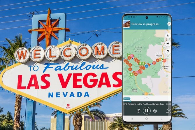
Begin at the Welcome to Fabulous Las Vegas sign for a quick photo stop. Ten minutes is enough for most people, though the attraction is more about the familiar image than a long visit.
Boulder City gives the day a useful historical beginning. The Boulder City and Hoover Dam Museum is free, easy to navigate, and open every day from 7 a.m. to 7 p.m. Its displays explain the workers and community behind the dam, since Boulder City was the home base for the people who built it.
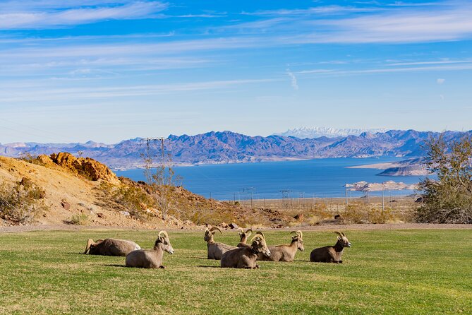
Hemenway Park is a pleasant change from casino streets and concrete. Green grass, Lake Mead views, and the chance of seeing wild bighorn sheep make it worth a short stop. Keep your eyes on the mountainsides, where the animals can blend into the rock.
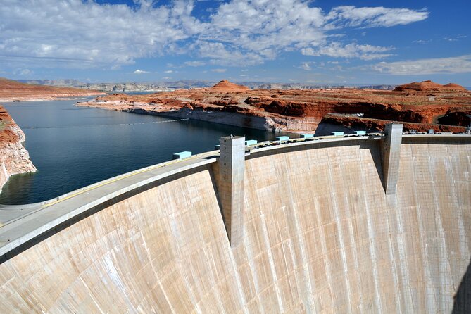
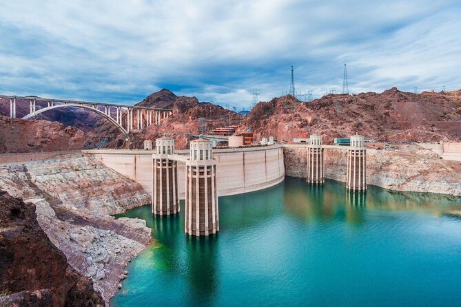
At Hoover Dam Lookout, you cross into Arizona for a broad view of the entire dam. This is an important detail because the view is different from the Nevada side, and the short drive over the rim adds a useful second angle before you park at the dam itself.
Plan about two hours at Hoover Dam. You can walk the premises without paying an admission fee, but parking may cost $10. Free parking is also available, and guided dam tours cost extra. The audio route can explain the engineering and history while leaving you free to choose how much time to spend on site.
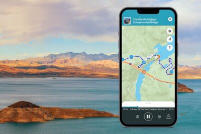
The Mike O’Callaghan and Pat Tillman Memorial Bridge, often called the Hoover Dam Bypass bridge, is one of the day’s best stops. The bridge rises almost 900 feet above the dam. You can walk toward the top for an impressive bird’s-eye view, and display boards along the switchback ramps explain how it was built. Parking and admission are free.
From there, the route turns toward Lake Mead. Lakeview Overlook offers a panoramic view above the marina, while the Lake Mead Visitor Center provides maps, exhibits, restrooms, a water filling station, and help from park staff. Use this stop to check trail details before committing to a longer walk.
The Historic Railroad Trail is one of the most worthwhile walks on this route. The flat path passes through old railroad tunnels once used to carry supplies during Hoover Dam construction. The full trail is 7.5 miles round trip, but you can walk about two miles and turn around after the first tunnels.
There is no shade, so the timing advice matters. From May through September, avoid the middle of the day and aim for early morning, before 10 a.m. The trail begins near the visitor center and an adjacent parking area.
Boulder Beach gives you a slower lake stop. You can swim, paddleboard, kayak, canoe, sail, gather shells, or simply look across the water toward the mountains. Scenic overlooks along Lakeshore Road add quick photo stops, while the Northshore Road drive brings volcanic, red-rock, and desert scenery.
The 33 Hole Overlook is more demanding. The 2.2-mile round-trip hike includes a rough scramble at the beginning and follows dramatic canyons below the former high-water line. You can also stop only for the view if the hike does not fit your day.
Back in Las Vegas, the Little White Wedding Chapel offers a small slice of old Downtown Vegas character. You can peek inside for free during opening hours, and parking is free. Finish at The STRAT if you want a high viewpoint over the city. The 1,149-foot tower has indoor and outdoor observation decks with 360-degree views, though observation admission is not included in the tour price.
Day two: Red Rock Canyon’s one-way scenic loop
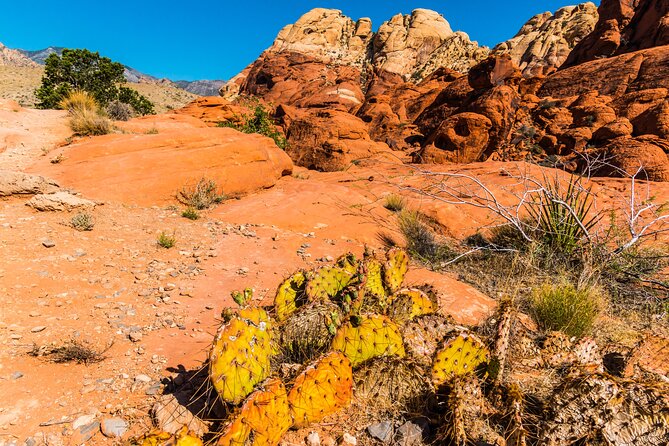
The Red Rock route begins about 10 miles west of Downtown Las Vegas on West Charleston Boulevard, also called Route 159, and ends at the same place. The route is a loop, so plan carefully because you will not circle back once you pass a stop.
Start at the Red Rock Canyon Visitor Center. It is the only place on the one-way scenic drive with running-water restrooms and a water refill station. You will also find maps, an information booth, outdoor exhibits, a gift shop, and live desert tortoises.
A reservation is required for the scenic drive during much of the year, so check before setting out. The drive is the main way to see Red Rock Canyon, and it includes nearly all the major pullouts and trail access points.
Calico 1 and Calico Hills provide your first close look at the area’s red stone. You can take photographs from the parking areas or walk part of the moderate Calico Hills trail, which runs two to six miles depending on the start and endpoint you choose.
Sandstone Quarry Overlook is the trailhead for the popular Calico Tanks hike. The old quarry cuts and remaining sandstone slabs offer a glimpse of earlier work, while rock climbers may appear high on the walls. Parking can be tight, so allow patience if you want to hike.
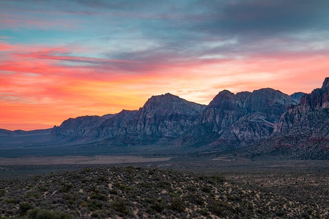
High Point Overlook and White Rock Trailhead are short stops with broad mountain views. White Rock sits at the scenic drive’s highest point, 4,771 feet above sea level. Get out, turn slowly, and take in the surrounding peaks.
Willow Spring is one of the day’s best places to spend time. The short Petroglyph Wall Trail reaches ancient rock art more than 800 years old. The Willow Springs Loop runs 1.5 miles round trip and passes an agave roasting pit. Bighorn sheep may watch from the ledges above, though their coloring makes them easy to miss.
Lost Creek Canyon offers the easy Children’s Discovery Trail, rocky in places with a boardwalk and a seasonal waterfall that usually flows from December through April. Ice Box Canyon is better suited to experienced hikers, but the parking area is still worth a stop for its scenery and birding.
Pine Creek Canyon, Oak Creek Canyon, and the Red Rock overlooks add varied views. Oak Creek requires a short gravel-road detour, but ordinary cars can manage it slowly. Mule deer sometimes move through the area, and the canyon opens toward the Red Rock Escarpment.
The final Red Rock overlook is among the finest viewpoints on the route. Walk the paved path from the helipad area past Joshua Trees to the benches at the end. Red Spring Picnic Area is another good place to stop for food with a mountain view.
Cowboy Up Trail Rides adds a different side of the desert. You may see horses, mules, and Jackson the Red Rock Burro. The Fossil Ridge Trail begins here, and horseback rides require a separate reservation.
Day three: Death Valley from dunes to Dante’s View
The Death Valley route is the biggest undertaking of the three. It begins from either the east entrance near Death Valley Junction or the west entrance near Panamint Springs, depending on the route you select. Bring water, fuel planning, and patience. The distances between stops make this a full day.
The optional Emigrant Canyon Road detour leads to Journigan’s Mill, Wildrose Campground, and the Charcoal Kilns. Journigan’s Mill has foundations, empty tanks, and other remains that may interest photographers and history fans. Wildrose Campground contains surviving Civilian Conservation Corps buildings.
The ten beehive-shaped Charcoal Kilns are the unusual highlight. They sit thousands of feet up in the Panamint Range, and you can step inside one. The road adds time, so use it only if the kilns appeal to you more than the main valley stops.
Stovepipe Wells Village is a practical place to eat or buy gasoline. In the park, Furnace Creek is the other key service area, but prices are higher than outside the park.
Mesquite Flat Sand Dunes are the only dunes on this three-day route. You can see them from the parking area, but walking among the mesquite trees makes the stop more memorable. The dunes are also suited to sunset and stargazing.
Nearby Devils Cornfield is a quick look at arrowweed plants that resemble ears of corn. Salt Creek Interpretive Trail is more rewarding for a short walk. Its half-mile boardwalk crosses a wetland and offers a chance to see the endangered Salt Creek pupfish.
Harmony Borax Works explains early mining in the valley with interpretive signs, old processing remains, and a wagon once pulled by a 20-mule team. At Furnace Creek Visitor Center, stop for maps, flush toilets, water, and exhibits about the area’s natural and human past.
The Ranch at Death Valley is the park’s main service stop. You can find food, gasoline, an ice cream parlor, a buffet-style restaurant, a Wild West saloon, a general store, and the Borax Museum. Expect higher prices, but this is the place to restock before continuing.
Devils Golf Course is a short dirt-road detour to a strange salt formation. There is no formal trail, and the salt can hurt your feet, so sturdy shoes matter.
Badwater Basin is the central highlight. At the lowest point in North America, you can walk from the parking area onto the salt flats. The boardwalk is easy, but reaching the geometric salt formations may require about a one-mile walk each way.
Natural Bridge Trail is a rocky, flat one-mile round trip. Artists Drive is a one-way road through a twisting canyon, with the colorful mineral bands at Artists Palette providing the best reason to stop and walk.
Golden Canyon offers a popular three-mile round-trip hike to Red Cathedral. It is a serious walk in exposed desert terrain, so you should judge the heat and your energy before setting out.
Zabriskie Point is a short but steep walk from the parking lot to one of the park’s classic views. Red Cathedral and Manly Beacon fill the scene, and the location also has film and music history, including its connection with U2’s Joshua Tree album cover.
Twenty Mule Team Canyon provides another bumpy dirt-road detour. Check current road conditions before taking it, and avoid it in low-clearance vehicles.
End at Dante’s View, more than 5,000 feet above Badwater Basin. From the overlook, you can see the salt flats below, the Panamint Range across the valley, and, on clear days, the Sierra Nevada and Mount Whitney. Sunset and stargazing are especially appealing here, but allow enough time for the drive back.
Same sights, a different narrator:
- Los Angeles: Hop-On Hop-Off Bus Tour with Audio Guide
★ 3.7 · 2,030 reviews - City Sightseeing Hop-On Hop-Off Bus Tour with Audio Guide
★ 3.0 · 1,083 reviews - Medieval Torture Museum Ticket with Audio Guide and Ghost Hunting
★ 5.0 · 962 reviews - San Francisco: Alcatraz, Ferry & Audio Tour w/ Night Option
★ 4.4 · 617 reviews
How the app works on the road
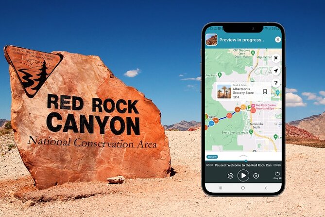
Book the experience and follow the email instructions to download the Shaka Guide app. Redeem the supplied code, download the selected route over strong Wi-Fi, then open the My Stuff tab and choose your starting point.
The audio, directions, map, and GPS continue offline. Stories play automatically as you drive, so you do not need to keep checking the screen. Reliable support is available by phone, chat, or email if you have trouble getting started.
The app is best used as a guide, not as a substitute for judgment. Confirm weather, road conditions, park rules, reservations, fuel, and water before leaving. You can also use the route selectively instead of treating every listed stop as mandatory.
Who should book this Las Vegas audio tour?
I would choose this for a self-directed group with a rental car or private vehicle, especially if several people can share the $13.59 cost. It suits independent hikers, photographers, families with mixed interests, and anyone who dislikes fixed departure times.
I would skip it if you want hotel pickup, a driver, included meals, or a live person handling every detail. The route covers a lot of ground, and the best experience comes from choosing a few priorities rather than racing through every stop.
Free cancellation is available up to 24 hours before the experience start time. Inside that window, changes and refunds are not accepted.
FAQ
How much does the audio tour cost?
The tour costs $13.59 per group, covering up to 15 people.
Does the price include transportation?
No. You provide your own private transportation.
Does the price include meals and refreshments?
No. Meals and refreshments are not included.
Are parking fees included?
No. Parking fees are separate. Hoover Dam parking may cost $10, though free parking is also available.
Can I use the tour without Wi-Fi or mobile data?
Yes. Download the tour, audio, map, and directions over strong Wi-Fi before you leave. GPS and the map work offline.
How long does the experience last?
The experience is designed for approximately three days, but the tours never expire and can be used on your own schedule.
Where does the Red Rock Canyon route begin?
It begins 10 miles west of Downtown Las Vegas along West Charleston Boulevard, also called Route 159, and ends at the same location.
Where does the Hoover Dam route begin?
The Hoover Dam route begins along Las Vegas Boulevard near Mandalay Bay.
Where can the Death Valley route begin?
The Death Valley route begins from either the east entrance near Death Valley Junction or the west entrance near Panamint Springs.
Is a reservation needed for Red Rock Canyon?
During much of the year, a reservation is required for the Red Rock Canyon Scenic Drive.
Can I choose only some of the stops?
Yes. You can select the stops that interest you, skip others, pause the tour, and resume it later.
Is the tour private?
Yes. Only your own group participates in the activity.
Are service animals allowed?
Yes. Service animals are allowed.
What is the cancellation policy?
You can cancel for a full refund at least 24 hours before the experience start time. Cancellations made less than 24 hours before the start time are not refunded.
Should you book it?
Book this audio tour if you want the freedom to build your own Las Vegas day trips and already have transportation. Its price is unusually low for a group, and the combination of offline maps, automatic narration, and flexible stops makes it a practical companion for three demanding desert routes.
The best plan is to choose priorities in advance. Give Hoover Dam and the Historic Railroad Trail their own focus, reserve enough time for Red Rock’s scenic loop, and treat Death Valley as a full, carefully planned day. If you do that, this app gives you useful structure without taking away your independence.
New audio tours around the USA
- Beaches, Bites and Bavaria in Leavenworth: A Self-Guided Audio Tour★ 3.5 · 3 reviews
- Welcome to Fabulous Las Vegas Sign Self-Guided Audio Tour★ 5.0 · 2 reviews
- Hoover Dam and Lake Mead Self-Guided Audio Tour★ 5.0 · 3 reviews
- Driving Lake Tahoe: A Self-Guided Audio Tour From Tahoe City to Incline Village★ 5.0 · 10 reviews
- Las Vegas Neon and Secrets: Self-Guided Audio Tour★ 5.0 · 3 reviews
- Baton Rouge Historic Downtown Self-Guided Audio Walking Tour★ 4.0 · 19 reviews
- Ultimate La Jolla Self-Guided Driving & Walking Audio Tour Bundle★ 3.5 · 9 reviews
- Knoxville’s Country Music Heritage: A Self-Guided Audio Tour★ 3.0 · 2 reviews
Las Vegas Audio Tours, compared.
Audio Driving Tour: Grand Canyon West, Hoover Dam Red Rock Canyon
Read our review →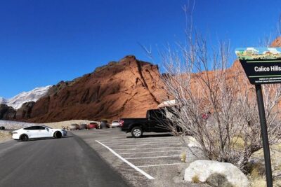


Lake Mead & Valley of Fire State Park Self-Guided Audio Tour
Read our review →
Las Vegas: GoCar Mob History Audio Tour & Mob Museum Ticket
Read our review →

Welcome to Fabulous Las Vegas Sign Self-Guided Audio Tour
Read our review →Browse the lists this tour appears in