
Review · CALIFORNIA
PCH: Big Sur Self-Guided Audio Tour from Monterey & Morro Bay
Big Sur is best experienced from your own car, with the ocean on one side and the Santa Lucia Mountains on the other. This self-guided tour adds location-triggered stories to the drive, pointing out sights you might otherwise pass at 45 miles per hour. You follow the Pacific Coast Highway from Monterey toward Morro Bay, stopping when the view wins the argument.
I like the hands-free audio and the very low price: $16.99 covers a group of up to four people, not four separate tickets. I also like the flexibility. You can pause for lunch, skip a stop, take a side trip, or use the tour again on another drive during its one-year validity.
The main caution is the technology. Cell service fades along much of Highway 1, and several people have had trouble finding the correct starting point or getting the audio to play reliably. Download the tour on strong Wi-Fi, read the setup directions before you leave, and begin in Monterey if you want the smoothest start.
Key points to know before you go

- A 125-plus-mile coastal route: The tour links Monterey, Carmel, Big Sur, San Simeon, Cambria, and Morro Bay.
- Audio begins by location: Stories play automatically as you reach marked points, so you can keep your eyes on the road.
- The main drive takes about two to three hours: Plan five to six hours if you want time for overlooks, walks, food, and side trips.
- One purchase covers the whole car: At $16.99 for up to four people, this is cheaper than a traditional guided outing.
- Download before reaching Big Sur: The route has weak or absent cellular service, especially between Carmel and San Luis Obispo.
- The route works best north to south: You will generally have easier access to ocean-side views and pullouts in that direction.
What this Big Sur audio tour actually gives you
This is not a bus tour or a scheduled excursion. No guide meets you, and nobody tells you when to leave your hotel. You receive access to Action’s Tour Guide app, a route map, a password, and audio stories tied to points along Highway 1.
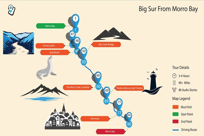
The route begins around Monterey and runs south for more than 125 miles. The listed drive itself can take two to three hours without long stops, but the full outing is better treated as a half-day or more. Add time for Point Lobos, beaches, overlooks, food, traffic, and the occasional pause when the ocean looks too good to ignore.
The narration covers scenery, bridge construction, wildfires, geology, local stories, and notable people connected with Big Sur. It is not meant to replace a ranger or a museum guide. Its value is that it keeps the drive from becoming a string of unnamed viewpoints.
The audio is location-based. Once you reach a marked point, the next segment should begin on its own. That is a useful setup on a twisting road where handling your phone is a poor idea. You can also pause the tour, skip a story, or listen again on a later trip.
More Self-Guided Audio Tours in the USA
- Gettysburg Battlefield Self-Guided Driving Audio Tour
★ 4.5 · 910 reviews - Joshua Tree National Park Self-Guided Driving Audio Tour
★ 4.5 · 762 reviews - Ultimate Acadia National Park Self-Guided Driving Audio Tour
★ 4.0 · 521 reviews
Start in Monterey, not in a hurry
The recommended starting point is in Monterey, even though the route passes close to Carmel. This detail has caused confusion, especially for people who expect to start in Carmel and find the app directing them back north.
You can technically begin in other places, but I would not make that your first attempt. Start the app while parked, confirm the correct tour version, and let the first story load before pulling onto Highway 1. If the app offers more than one direction or starting point, choose the version matching your route.
The tour runs from 6:00 AM to 9:00 PM daily. That gives you flexibility, but daylight still matters. Big Sur’s pullouts and coastal views are best enjoyed when you can see them clearly, and stopping after dark is not the point of this drive.
Point Lobos and the first stretch of Highway 1
After passing Carmel, the route leads toward Point Lobos Natural Reserve. This is one of the strongest early stops because it gives you a first taste of the rocky coves, coastal vegetation, and open Pacific views that define the route.
The tour does not include admission fees, reservations, or attraction passes. If you decide to enter a paid or managed site, that cost is yours. Treat the audio tour as a driving companion, not an all-inclusive ticket.
Soon you enter the famous Big Sur section of Highway 1. The road becomes the experience itself. The narration helps you notice the engineering behind the curves and bridges, as well as the fires and natural forces that have shaped this road.
Partington Cove, Garrapata, and Bixby Creek Bridge
Partington Cove is a small inlet reached by a dirt trail, wooden bridge, and tunnel. The stop is free, but it is not simply a roadside photograph. You need to walk down to the cove, so allow more than the brief audio segment if you want to see it properly.
Garrapata State Park brings wide coastal views and access to Garrapata Beach. The tour connects the scenery with the wildfires that regularly affect coastal forests. That context is useful because Big Sur can look permanent and untouched, even though fire, erosion, rockfall, and road repairs are part of life here.
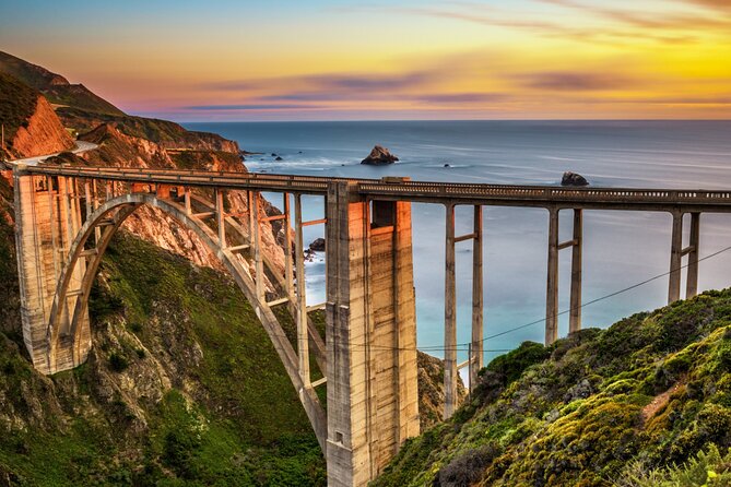
Then comes Bixby Creek Bridge, one of California’s most photographed bridges. Its graceful concrete arch looks especially striking against the cliffs and water. Parking can be limited around popular viewpoints, so do not assume the first good look will also be the easiest place to stop. Follow posted signs and avoid blocking traffic.
I like this early run of stops because it mixes short walks, beach access, scenery, and road-building stories. The drawback is that the audio segments are brief, often around five minutes. That keeps the driving moving, but curious listeners may want more detail.
Same sights, a different narrator:
- Los Angeles: Hop-On Hop-Off Bus Tour with Audio Guide
★ 3.7 · 2,030 reviews - City Sightseeing Hop-On Hop-Off Bus Tour with Audio Guide
★ 3.0 · 1,083 reviews - Medieval Torture Museum Ticket with Audio Guide and Ghost Hunting
★ 5.0 · 962 reviews - San Francisco: Alcatraz, Ferry & Audio Tour w/ Night Option
★ 4.4 · 617 reviews
Point Sur, Andrew Molera, and Pfeiffer Canyon
As you continue south, the narration points out Point Sur and its lighthouse. The lighthouse is a memorable sight from the road, but visiting it requires a separate detour and is not included in the tour price.
Andrew Molera State Park follows. The park adds another chance to leave the car and see a quieter side of Big Sur. The audio also touches on the area’s literary connections, a welcome change from nonstop scenery. Big Sur has long attracted writers and artists, and that cultural thread gives the coast a human story.
Pfeiffer Canyon Bridge comes next. Bixby gets most of the photographs, but this bridge has its own setting and character. The tour also points you toward Pfeiffer Beach, reached by Sycamore Canyon Road near Big Sur Station.
Pfeiffer Beach is a worthwhile detour, but the road is unsigned and easy to miss. Pay close attention, drive carefully, and allow time to find your way back to Highway 1. This is exactly the sort of side trip a location-based guide can help you notice, although you should not expect the app to handle every parking or road condition for you.
Grimes Point, McWay Falls, and Big Creek
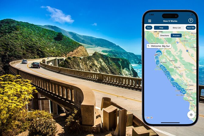
Grimes Point Scenic Overlook gives you one of the broadest views of the Big Sur coast. This is a good place to stop simply to watch the highway trace the edge of the mountains. The route then continues toward Seal Beach Overlook, where you may spot seals resting near the water.
McWay Falls is one of the essential stops. The waterfall drops about 80 feet toward the coast and flows year-round. Its setting is unusual and photogenic, but do not treat the audio stop as a promise of unlimited viewing time. Parking, paths, and access can change, so follow current signs at the site.
The road then crosses Big Creek Bridge and passes Big Creek Cove Beach. The bridge, creek, and nearby protected marine areas show how much of this coast is both scenic and carefully managed. You get a stronger sense of the area when you stop thinking only in terms of photo points and start noticing the connection between water, forest, wildlife, and road engineering.
Limekiln State Park adds beaches and forest. It is another reminder that Big Sur is not one single type of scenery. The coast shifts from open cliffs to shaded trees, narrow creeks, and small coves.
Pitkins Curve and the forces that threaten the highway
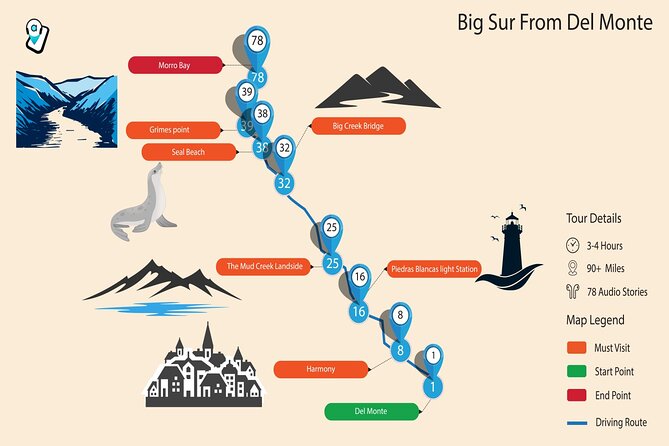
Pitkins Curve Bridge is one of the most useful stops for understanding why Highway 1 sometimes closes. The narration covers landslides, mudslides, rockfalls, earthquakes, and other hazards that threaten the road.
This section gives the tour some practical depth. Big Sur is not a polished theme-park road. It is a narrow route built into a demanding coast, and closures can happen. Before setting out, check current road conditions through official California transportation sources. An audio tour cannot reroute you around every fresh slide or closure.
Farther south, Jade Cove is known for nephrite jade along the beach. Access and conditions can vary, so use care and follow local rules. The Nathaniel Owens Memorial Redwood Grove offers a very different scene, with tall coastal redwoods that can reach roughly 350 feet, about the height of a 35-story building.
The contrast is the pleasure here. In one stretch you have steep ocean cliffs, then redwood shade, then another bridge or beach. The tour works best when you leave room for these changes instead of racing to the next audio trigger.
Ragged Point to San Simeon
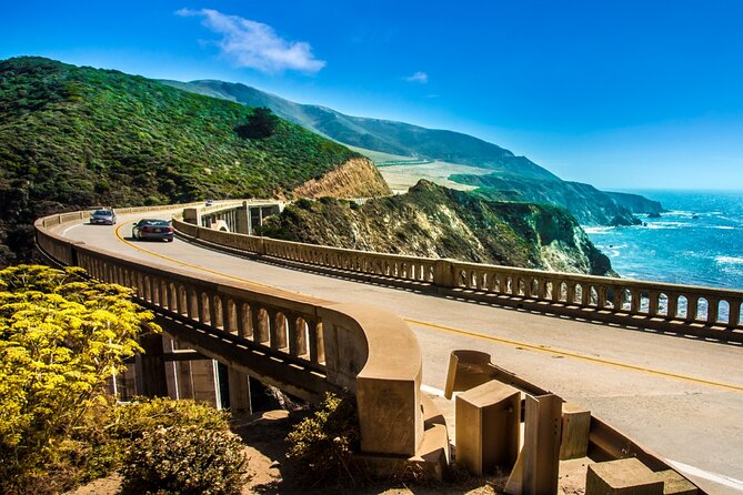
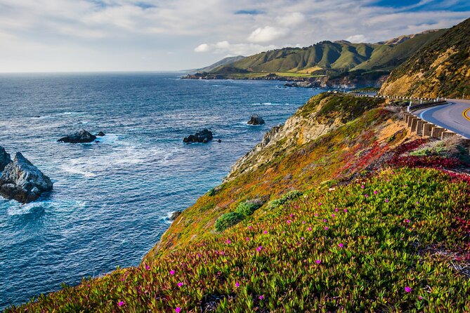
Ragged Point marks one of the most dramatic sections of the drive. The road follows the meeting point of the Santa Lucia Mountains and the Pacific, with frequent views and pullouts. The audio segment here is longer, around ten minutes, which suits the scale of the scenery.
This is another reason I favor driving north to south. You are positioned closer to the ocean side of the road, and many stops are more convenient in that direction. A weekday with light traffic can make the experience calmer, though no tour can guarantee quiet roads or clear weather.
The route passes Piedras Blancas Lighthouse, where you may detour for a visit. Then comes Elephant Seal Vista Point, one of the most memorable wildlife stops on the entire route.
Northern elephant seals gather here during different parts of their yearly cycle. They mate, give birth, molt, and rest onshore, while spending much of the year at sea. The narration explains that they can reach depths of about 5,800 feet and remain underwater for up to two hours. You do not need a long hike or a paid attraction to make this stop worthwhile. The animals and coastline provide the show.
Hearst Castle, Moonstone Beach, and Cambria
Near San Simeon, you can detour to Hearst Castle, the estate built for publishing figure William Randolph Hearst between 1919 and 1947. Entry requires a separate ticket and reservation, so this is best treated as an optional addition rather than part of the audio tour.
Moonstone Beach Drive offers a gentler final stretch along the coast. It is an easy detour from the main highway, and the route helps you reconnect with Highway 1 afterward. This is a useful stop if you want one last ocean view before heading inland toward Morro Bay.
In Cambria, look for Nitt Witt Ridge, a wonderfully odd house built by artist and former garbage collector Arthur Harold Beal. Beer cans, car parts, washer drums, and other discarded objects form part of the structure. It is a small, eccentric counterpoint to the grand bridges and sweeping views earlier in the day.
The route ends around Morro Bay, with San Luis Obispo and Pismo Beach also part of the southern reach. Morro Bay makes a sensible endpoint because it gives you a clear finish rather than leaving you wondering where the tour stops.
The app, offline use, and common trouble spots
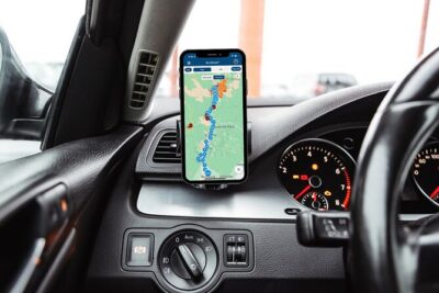
The app is simple in concept, but setup deserves attention. After booking, look for an email and text containing instructions and a password. Search for audio tour if you cannot find them. Download Action’s separate Tour Guide app, enter the password, and download the tour while you still have strong cellular service or Wi-Fi.
The most important rule is download before Monterey or Carmel. Large stretches between Carmel and San Luis Obispo have weak or absent service. The tour is designed to work offline after the download, but that only helps if you complete the download first.
A few practical habits can prevent most problems:
- Open the app while parked, not while pulling into traffic.
- Check that the correct direction and starting point are selected.
- Keep the phone charged and connected to the car’s audio system if possible.
- Do not rely on Apple CarPlay features working perfectly.
- If a story does not start, stop safely before troubleshooting.
- Contact support if the audio repeatedly cuts out.
The location triggers are the best feature when they work. They are also the area most likely to frustrate you when the setup is wrong. Some audio sections feel widely spaced, and a few directions may arrive too late for an easy stop. Use the map as a guide, but keep your eyes on road signs and traffic.
Is $16.99 good value for a Big Sur drive?
For a group of up to four, the price is hard to criticize. A single purchase covers the car, and you can use the tour over multiple days and return trips during the stated one-year period. That matters if you are making a shorter first drive and planning to return for more of Big Sur later.
The value is not in admission savings because attraction tickets and reservations are separate. It is in the route planning, automatic stories, offline map, and reminders about places you might miss. You get more direction than a basic scenic drive, but less personal help than a live guide.
The tour is a good fit if you want independence, enjoy driving, and prefer choosing your own stops. It is less suitable if you want someone to handle navigation, parking, road updates, and timing for you.
Who should book this experience?
I would choose this tour for a couple or family sharing one rental car, especially if nobody wants to spend hours researching every overlook before departure. It also suits repeat visitors who like the idea of using the same audio on a second trip.
I would be cautious if your phone is unreliable, if you dislike troubleshooting apps, or if your route is likely to change because of road closures. In that case, download everything early and treat the tour as optional support rather than your only source of directions.
The narration is strongest when it explains bridges, fires, road hazards, wildlife, and local oddities. It is lighter in some stretches, and repeated reminders to follow the map can become tiresome. Still, the automatic playback and low group price give it a useful role on this long, sometimes confusing road.
FAQ
How long does the Big Sur audio tour take?
The core route can take about two to three hours of driving. Plan five to six hours if you want time for beaches, overlooks, walks, food, wildlife stops, and optional detours.
Where does the tour start and end?
The recommended starting point is in Monterey, with the route continuing through Carmel, Big Sur, San Simeon, Cambria, and Morro Bay. The southern section ends around Morro Bay, San Luis Obispo, and Pismo Beach.
Does a guide meet me at the starting point?
No. This is a private, self-guided activity. You go to the starting point, open the app, and follow the audio and map yourself.
Do I need cellular service during the drive?
You need strong Wi-Fi or cellular service to download the tour before starting. After the download, the audio and maps work offline, which is important because much of the route has weak or absent service.
Are admission fees included?
No. Attraction passes, entry tickets, and reservations are not included. This applies to places such as parks, Hearst Castle, or any other site requiring separate payment.
Can I use the tour more than once?
Yes. The tour can be used over multiple trips during the stated one-year validity period. You can also pause it, take side trips, and continue later.
What happens if I need to cancel?
You can receive a full refund if you cancel at least 24 hours before the scheduled start time. Cancellations or changes made within 24 hours are not refundable.
Should you book the Big Sur audio tour?
Book it if you want a low-cost layer of guidance without surrendering control of your day. At $16.99 per car, the route planning and automatic stories are useful, especially for first-time drivers who want help spotting Partington Cove, McWay Falls, elephant seals, bridges, and smaller points of interest.
Do the setup before you leave, start in Monterey, and check road conditions. If the app behaves, this turns a beautiful but information-light drive into a more engaging one. If you expect a live guide, guaranteed technical support on the road, or detailed commentary at every bend, choose a different format. For an independent Highway 1 road trip, though, it is a sensible buy at a very modest price.
New audio tours around the USA
- Beaches, Bites and Bavaria in Leavenworth: A Self-Guided Audio Tour★ 3.5 · 3 reviews
- Welcome to Fabulous Las Vegas Sign Self-Guided Audio Tour★ 5.0 · 2 reviews
- Las Vegas Day Trips: 3-Day Self-Guided Audio Tour★ 5.0 · 2 reviews
- Hoover Dam and Lake Mead Self-Guided Audio Tour★ 5.0 · 3 reviews
- Driving Lake Tahoe: A Self-Guided Audio Tour From Tahoe City to Incline Village★ 5.0 · 10 reviews
- Las Vegas Neon and Secrets: Self-Guided Audio Tour★ 5.0 · 3 reviews
- Ultimate La Jolla Self-Guided Driving & Walking Audio Tour Bundle★ 3.5 · 9 reviews
- Baton Rouge Historic Downtown Self-Guided Audio Walking Tour★ 4.0 · 19 reviews
California Audio Tours, compared.
Yosemite National Park Self Guided Driving Audio Tour Guide
Read our review →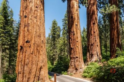
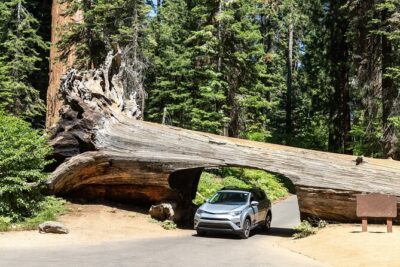
Self-Guided Audio Driving Tour in Sequoia and Kings Canyon
Read our review →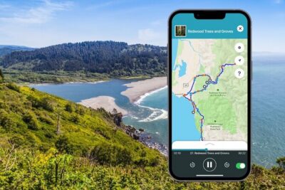
Self Guided Driving Audio Tour of Redwood National and State Park
Read our review →

Lassen Volcanic National Park Self-Guided Audio Driving Tour
Read our review →
Redwood National and State Parks Self-Guided Audio Driving Tour
Read our review →Browse the lists this tour appears in