
Review · CANADA
Icefields Parkway Self-Guided Driving Audio Tour
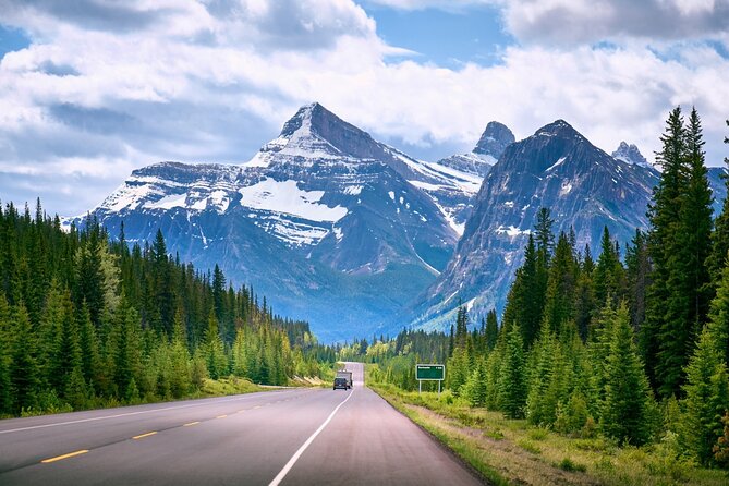
The best thing about this self-guided drive is that it turns a spectacular road into a story. As you travel from Jasper toward Lake Louise, the audio points out turquoise lakes, mountain passes, waterfalls, glaciers, and old exploration routes that are easy to miss when you are focused on the road. I especially like the location-triggered narration and the fact that one purchase covers everyone in a car of up to four people.
I also like the freedom to stop, skip, pause, and restart without keeping pace with a bus or guide. The main catch is the setup. You must download a separate app, enter a password, and launch the correct direction of the tour. A few people have had trouble getting it to play at first, so do the technical work before you reach the parkway.
Key things to know before you drive
- More than 140 miles of scenery: The route links Jasper and Lake Louise, with more than 76 stories along the way.
- One price per car: At $16.99 for up to four people, the cost is low compared with a private guide or organized excursion.
- Offline playback: Download the tour over strong Wi-Fi or cellular service before setting out.
- Best for independent drivers: You choose your stops, walking time, meal breaks, and pace.
- A strong mix of nature and human stories: The narration covers glaciers and geology, but also explorers, Indigenous guides, mountain names, and early transport routes.
- Check the direction carefully: This version begins in Jasper. A separate version begins near Lake Louise.
A road trip with a narrator in the passenger seat
The Icefields Parkway is easy to admire and surprisingly easy to experience as one long blur of mountains. This audio tour gives the drive some shape. It tells you what you are approaching, explains why it matters, and suggests which pullouts or short walks deserve your time.
The route contains more than 76 audio stories, though the listed highlights are organized into 34 numbered stops plus several introductory points. The full drive is described as taking about three to four hours, but that is best understood as the audio route itself. If you stop at waterfalls, hike to viewpoints, or take side trips, plan on much longer.
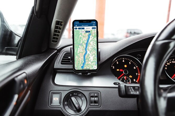
The app uses your location to play stories automatically. You do not need to keep reaching for your phone while driving. You can connect the phone to your car by Bluetooth, USB, or AUX, and playback works with Apple CarPlay. Android Auto support is listed as forthcoming, so Android users should plan to use the phone or another connection method.
The voice and pacing are important here. Strong feedback focuses on the calm delivery and useful timing of the narration. There is no music between points, which some people may miss, but the spoken information is the main reason to buy this experience.
More Driving Audio Tours in Canada
- Cabot Trail: a Smartphone Audio Driving Tour
★ 4.5 · 118 reviews - Icefields Parkway: a Smartphone Audio Driving Tour
★ 4.0 · 118 reviews - Smartphone Audio Driving Tour between Banff and Calgary
★ 4.0 · 25 reviews
Starting in Jasper, with one important direction check
This version begins in Jasper and ends near Lake Louise. The opening message specifically warns you to select the right starting point. If you begin near Lake Louise, use the separate Lake Louise version instead.
That detail matters because this is not a live tour with someone waiting at a meeting point. You go to the first story location, open the Action’s Tour Guide app, and let the route begin. If you have more than one tour in the app, choose the one matching your starting point and direction.
Download the tour while you still have a strong connection. The parkway includes long stretches where cellular service may be poor or absent. Once the route is downloaded, the maps and stories work offline.
I would also save the setup email and text message before leaving. They contain the password needed to activate the app. One smart backup is to print the stop list or save it on your phone, especially if you want to decide in advance which walks to include.
Jasper’s first stops: lakes, cliffs, and fast water
The opening section introduces the Jasper SkyTram and Whistler Mountain. The story about early skiers is a good example of the tour’s approach. It links modern recreation with the awkward beginnings of mountain travel, when skiers had to work their way uphill with a simple tow rope.
The first major stop is the Valley of the Five Lakes Trailhead. The roughly three-mile loop takes about an hour and a half and passes five lakes with striking blue and turquoise water. The audio explains how glacial material affects the color, giving you more than a quick photo stop.
At Athabasca Pass Lookout, you get a view toward the South Jasper Mountain Range and Mount Edith Cavell, which rises to 11,033 feet. This is a short stop, useful if you want a mountain view without committing to a hike.
Horseshoe Lake brings a more dramatic story. The U-shaped lake is surrounded by rock walls and is known for cliff jumping from a height of about 75 feet. The narration describes the thrill, but you should treat this as information, not an invitation. The water is cold, and the activity carries obvious risk.
At Athabasca Falls, the focus shifts to geology. Water cuts through a canyon shaped after glacial retreat during the last Ice Age. The falls drop about 75 feet, and the short stop works well for people who want a powerful view without spending half a day on a trail.
Mountain names and glacier water
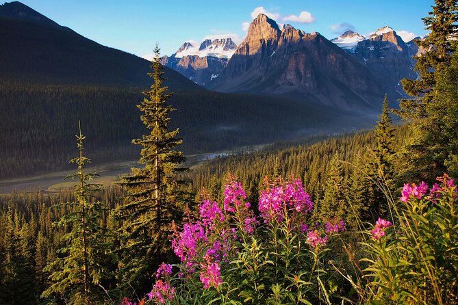
The road then passes Mount Kerkeslin, the highest peak in the Maligne Range at 9,790 feet. The stories about mountain names add a human scale to the huge setting. Mount Christie, for example, was named by James Hector for William Joseph Christie, who hosted Hector during his Rocky Mountain expedition.
At Goats and Glacier Lookout, look toward the Athabasca River and the Fryatt Mountain Range. The narration explains the name through the mineral-rich cliff, where mountain goats may come to lick salt from the rock. Wildlife is never guaranteed, but the story gives you a reason to study the cliff instead of simply driving past it.
Honeymoon Lake is a quieter stop, with reflected mountains and the possibility of seeing canoes on the water. It offers a change of pace after the larger viewpoints.
The next waterfall is Sunwapta Falls, reached by an easy trail of about two miles that takes a little over an hour. The falls are fed by the Athabasca Glacier and drop around 60 feet. The name comes from the Stoney-Nakoda word for turbulent water, a useful reminder that many place names here describe what the water or terrain does.
More Self-Guided Audio Tours in Canada
- Self Guided Audio Driving Tour of the North Shore of PEI
★ 4.0 · 24 reviews - Self-Guided Audio Driving Tour in Icefields Parkway
★ 5.0 · 24 reviews - Self-Guided Audio Tours for the Canadian Rockies
★ 5.0 · 18 reviews - Discover the Rockies: 6 Self-Guided Smartphone Audio Tour Bundle
★ 4.0 · 10 reviews
The middle stretch: ridges, creeks, and ice
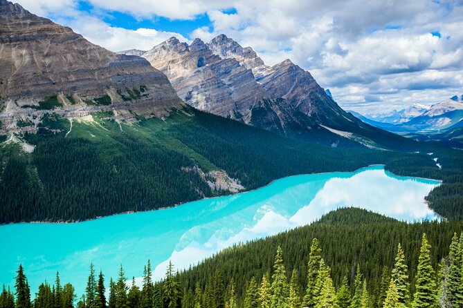
The Endless Chain Ridge is a line of craggy peaks more than 9,000 feet high. The narration covers the ridge’s ancient formation and later uplift, giving you a quick lesson in how pressure below the earth shaped the peaks above.
At Poboktan Creek, the tour points out the parking area for a trail that runs about 24 miles and usually takes four days. This is not a casual roadside walk. The value of the stop is knowing what lies beyond the first stretch of trees and understanding the scale of the backcountry.
A brief stop near Alberta 93 focuses on a pile of rocks that records the area’s geological past. It is exactly the sort of feature you might ignore without an explanation.
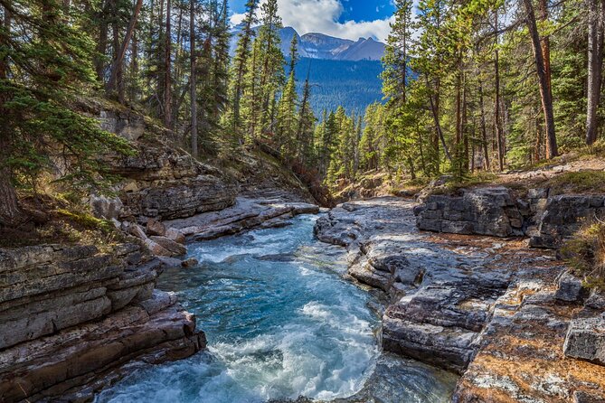
Beauty Creek offers another lesson in cold water. The creek is fed by meltwater, and farther into the wilderness, Stanley Falls drops about 40 feet into a blue pool. In colder months, the cascades can freeze into sheets of ice. The audio helps you picture what changes here through the seasons, even if your own visit is during summer.
At Stutfield Glacier Viewpoint, you can see a large glacier from the road. The narration points out the double icefalls, where steeper ice creates crevasses. This is a good place to remember that a glacier is moving ice, not simply a permanent white patch on a mountain.
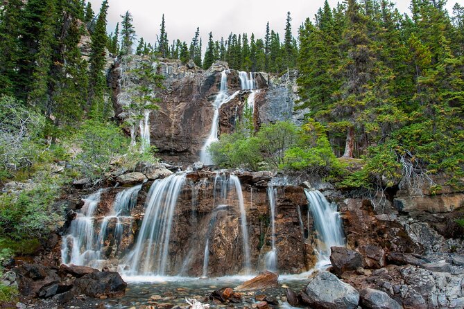
Tangle Creek Falls drops about 90 feet beside the parkway. Spray can reach the road, making this one of the easiest waterfalls to spot. The story also introduces Mary Schäffer Warren, who named Tangle Creek and Endless Chain Ridge, and Samson Beaver, a Stoney-Nakoda guide who accompanied her on many journeys. That pairing adds useful context to the old exploration stories.
The Columbia Icefield section deserves extra time
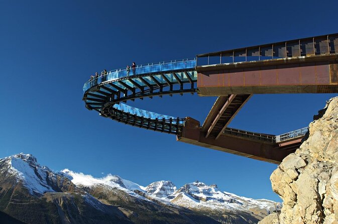
The Columbia Icefield is where the drive feels most dramatic. The optional Columbia Icefield Skywalk extends about 100 feet over the Sunwapta Valley on a glass-floored walkway, with the valley more than 900 feet below. It is an attraction with its own admission, and that cost is not included in the audio tour.
Mount Kitchener rises to 11,499 feet. The story explains the mountain’s name and its connection to Horatio Kitchener, a British officer who died in 1916 when his ship sank after striking a mine.
At the Toe of the Athabasca Glacier Trailhead, a hike of just over one mile brings you closer to the glacier. This is one of the most useful suggested stops because it turns a distant view into a clearer sense of the ice itself.
The Wilcox Pass Trail is listed as a challenging seven-mile hike, but you do not need to complete the full route to enjoy it. Many people walk a little more than a mile to a viewpoint looking toward Mount Snow Dome. The Parker Ridge Trail offers another longer option, about four miles and a little over two hours, with alpine meadows, views of the Columbia Icefield, and a fresh angle on the blue lakes.
If you prefer a shorter walk, Panther Falls is reached by an easy trail of about 1.5 miles and roughly 30 minutes. You can continue another mile to Bridal Veil Falls, creating a useful two-waterfall stop without a full-day hike.
The Weeping Wall is a series of cliffs about 900 feet high. Water may seep from the springs above, but the flow varies with the season and conditions. It is a good example of why the audio is useful: you know what to watch for, even when the feature is subtle.
Banff’s northern approach: rivers, lakes, and famous viewpoints
The road passes Mount Coleman, then reaches the HI Rampart Creek Wilderness Hostel. The short story here connects the simple hostel with the growth of mountain tourism almost a century ago.
At Saskatchewan River Crossing, the narration turns to transport. In 1882, John Walter operated a crude crossing where a horse and carriage could be guided across the river on a floating plank. It is a small story, but it helps you picture how difficult this route was before modern roads.
Howse River Viewpoint is recommended as a must-see pullout, with views toward the river and surrounding mountains. The Mistaya Canyon Trailhead offers a shorter walk of about 1.5 miles and 40 minutes to a gorge carved by rushing water.
Mount Chephren reaches 10,715 feet. Its angular shape first led to the name Pyramid Mountain, but another summit already had that name. The later name refers to the Egyptian pharaoh responsible for the second-largest pyramid at Giza.
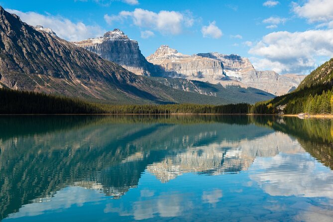
At Waterfowl Lake, the emerald water sits close to the road, so you can see it without a long walk. The story also links the area to the hippie movement of the 1960s, an unexpected cultural note in a route otherwise dominated by geology and mountain exploration.
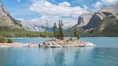
The Snowbird Glacier viewpoint looks toward Mount Patterson. The glacier’s shape resembles outstretched wings, which explains the name. At Peyto Lake, a side road leads to an overlook and a roughly two-mile trail around the lake. The bright turquoise color comes from glacial material suspended in the water.
Bow Lake reflects Mount Jimmy Simpson, named for an English immigrant. The Crowfoot Glacier viewpoint explains how the glacier once had three lobes, shaped like a crow’s foot, and has since lost one.
The route continues past the Wapta Icefield, whose name comes from a Stoney-Nakoda word for running water, and reaches Hector Lake Viewpoint. Hector Lake sits below Lilliput Mountain and Mount Balfour and is a strong final photo stop before Lake Louise.
Keep driving another five to ten minutes after the final story to reach Lake Louise.
What $16.99 really buys you
At $16.99 per group of up to four, this is inexpensive if you are already driving the parkway. Split across four people, the cost is only a few dollars each. Even for two people, it is a modest charge for several hours of route planning, narration, offline maps, and historical context.
The value is not in admission to attractions. You still pay separately for the Skywalk and any other attraction passes, reservations, or tickets. The value is in helping you decide where to stop and explaining what you are seeing.
A bus tour may offer a person in front of you, but this option gives you control. You can pause for lunch, spend longer at Athabasca Falls, skip a hike, or return to a story later. It is also private, so only your own group participates.
The main limitation is that the stated three to four hours does not include all the hikes and side stops. If you try to walk the Valley of the Five Lakes, Sunwapta Falls, Wilcox Pass, Parker Ridge, Panther Falls, Mistaya Canyon, and Peyto Lake in one outing, you will need far more time.
Who should use this audio tour?
I would choose it for a self-drive group that wants structure without a fixed schedule. It suits couples, families, and older adults who prefer to stop often and avoid rushing between set departure times.
It is also useful if you know little about the parkway but do not want a full guided excursion. The narration gives you enough background to make sensible choices about short walks and major viewpoints.
You may want another plan if you dislike app setup or do not want to use a phone while driving. The initial activation can be confusing. Downloading at home is not always enough, so open the app and test the tour before you leave.
The tour is designed for iPhone devices using iOS 15 or later, Android devices using version 9 or later, or an iPad or tablet with GPS and cellular capability. Support staff can help with audio problems, but it is wise to prepare before entering a low-signal area.
Should you book the Icefields Parkway audio tour?
Book it if you are driving from Jasper toward Lake Louise and want a low-cost guide that works around your own schedule. The strongest reasons are the location-based playback, the large number of stops, and the useful mix of waterfalls, glaciers, geology, and local stories.
Skip it if you want a live guide, included attraction tickets, or a completely effortless start. The app requires preparation, and you must choose the correct direction.
For most independent drivers, I think the price is easy to justify. Download it over strong Wi-Fi, save the password, test the app, and leave plenty of time for the stops that catch your eye. The parkway is the main event. This tour simply helps you notice more of it.
FAQ
How long does the Icefields Parkway audio tour take?
The audio route takes about three to four hours. That estimate does not include extended hikes, attraction visits, meal breaks, or other side trips.
Where does this version of the tour begin?
This version begins in Jasper and travels toward Lake Louise. A separate version is available for starting near Lake Louise.
Where does the tour end?
The tour ends at Lake Louise. After the final story at Hector Lake, continue driving for about five to ten minutes to reach Lake Louise.
How many audio stories are included?
The route includes more than 76 audio stories across more than 140 miles of the Icefields Parkway.
Does the tour work without cell service?
Yes. You must download the tour while you have strong Wi-Fi or cellular service. After downloading, the audio and maps work offline.
Do I need to meet a guide?
No. This is a private, self-guided activity. No guide meets you at the starting point, and your group follows the app.
How do I start the audio?
After booking, download the separate Action’s Tour Guide app and enter the password sent by email and text. Go to the first story point, open the correct tour, and the audio should begin automatically based on your location.
Are attraction tickets included?
No. Attraction passes, entry tickets, and reservations are not included. This includes optional attractions such as the Columbia Icefield Skywalk.
Can I pause or reuse the tour?
Yes. The tour has lifetime access with no expiry. You can pause it, take breaks, use it on different days, and use it again on future trips. Cancellation is free up to 24 hours before the scheduled start time.
New audio tours around Canada
- Kelowna E-Bike Bee Tour, Tastings, Organic Lunch & Audio Guide★ 5.0 · 9 reviews
- Smartphone Audio Driving Tour between Kamloops & Revelstoke★ 3.5 · 8 reviews
- Jasper National Park Self-Guided Driving Audio Tour★ 4.0 · 4 reviews
- Smartphone Audio Driving Tour between Kamloops and Vancouver★ 3.5 · 5 reviews
- Smartphone Audio Driving Tour between Huntsville & Toronto★ 4.5 · 4 reviews
- Halifax Explosion Smartphone Audio Walking Tour★ 4.0 · 3 reviews
- Edmonton Self Guided Audio Experience★ 3.0 · 2 reviews
- Smartphone Audio Driving Tour between Collingwood and Toronto★ 4.5 · 3 reviews
Canada Audio Tours, compared.
A 7th-Gen Local’s View of Downtown Charlottetown: An Audio Tour
Read our review →

Halifax Churches, Gardens & Graveyards: a Smartphone Audio Walking Tour
Read our review →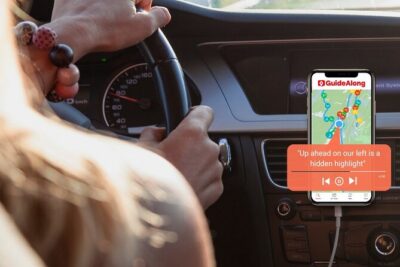
Western Canada Self-Driving Audio Guide English and German
Read our review →Browse the lists this tour appears in