
Review · USA
Ultimate Portland Self-Guided Driving GPS Audio Tour
Portland’s compact streets and far-reaching harbor are a good match for a self-guided car tour. This route covers roughly 12 miles and 33 audio stories, taking about one to two hours without long stops. You hear about shipbuilding, fires, architecture, Prohibition, local writers, and Casco Bay while the GPS tells you when to listen.
I like the freedom to stop for coffee, photos, or a longer look at a neighborhood without holding up a group. I also like the price: $16.99 per carload of up to four people, which is far less than paying separately for a guided tour. The main caution is navigation. Road closures, weak GPS syncing, or starting from the wrong point can cause you to miss a section, so download everything on strong service and follow the route closely.
Key points to know before you drive

- More than 33 stories across 12 miles: The route links central Portland, the Eastern Promenade, South Portland, and Fort Williams Park.
- A true private experience: Only your group rides together, with no bus schedule or strangers to wait for.
- Offline audio and maps: Download the tour before leaving reliable Wi-Fi or cellular service.
- Strong value for families and couples: One purchase covers up to four people in the same car.
- Useful in poor weather: A car keeps you warm and dry during rain, cold snaps, or snow flurries.
- Some GPS patience is needed: Construction and emergency roadblocks have caused missed sections, and the app may not always reroute perfectly.
Portland by car, from the harbor to Fort Williams
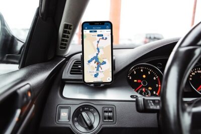
This is not a hop-on, hop-off sightseeing bus. You drive your own car while the Action Tour Guide app plays stories automatically as you reach specific points. The route begins at the Portland, Maine Information Center at Ocean Gateway Pier and returns to the meeting point after passing through several parts of Portland and South Portland.
The audio is in English. You receive setup instructions and a password by email and text, then download the separate Action Tour Guide app. Once the tour is on your phone, it works offline. Connect your phone to the car stereo by Bluetooth, USB, or AUX for the clearest sound.
The route is designed for a normal drive, not a race. Keep to the speed limit and listen for the full story before moving on when possible. If the GPS triggers too early or cuts off the last word, slowing down can help. You can also pause a story and replay it later.
The lifetime access is a useful feature. You can start the tour on one day, stop for lunch, and finish later. You can also use it again on a future trip. That flexibility matters in Portland, where a quick drive can easily turn into a longer afternoon near the waterfront or at Fort Williams Park.
More Self-Guided Audio Tours in the USA
- Gettysburg Battlefield Self-Guided Driving Audio Tour
★ 4.5 · 910 reviews - Joshua Tree National Park Self-Guided Driving Audio Tour
★ 4.5 · 762 reviews - Ultimate Acadia National Park Self-Guided Driving Audio Tour
★ 4.0 · 521 reviews
West Street opens with Barbara Bush and Portland’s medical legacy

The first stop is on West Street, near Maine Medical Center and the Barbara Bush Children’s Wing. The story connects Portland with Barbara Bush, who spent much of her life in Kennebunkport and worked to raise money for children facing serious illnesses.
This is a quiet opening rather than a grand architectural stop. Its value is the local connection. You get a sense of how Portland’s public figures and nearby communities fit into the city’s story.
From there, the route moves toward Victoria Mansion. Built in 1858 by Ruggles Morse as a summer home, the mansion is known for its Victorian architecture and interior decoration. The audio gives you a reason to look beyond the building’s façade and consider how wealthy families used Portland as a seasonal base.
You then pass colorful brick rowhouses originally built for servants. Today, many are expensive condominiums. That change says a lot about Portland’s housing market and the way older working-class buildings can gain new value over time.
The route also explains why brick became so common in Portland. After repeated fires, builders moved away from wood construction. As you drive, the brick buildings are not just attractive old façades. They are evidence of the city’s effort to protect itself from another disaster.
Harbor stories and the city’s Prohibition connection
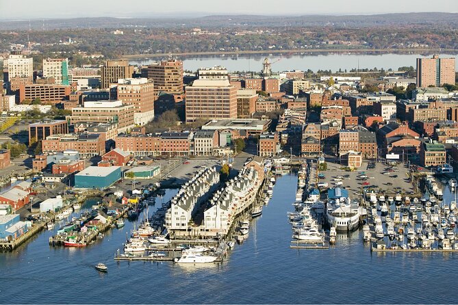
Portland Harbor is one of the route’s most useful geography lessons. It is part of Casco Bay and is described as a deep-water port that generally avoids freezing during winter. Strong tides in the Gulf of Maine mix the water and bring warmer water toward the surface.
That information is easy to miss if you simply drive around the waterfront. Here, the harbor becomes part of the reason Portland developed as a port city and remained useful through the seasons.
You also pass the home of Neal Dow, a former Portland mayor known for pushing statewide Prohibition in 1851. His law banned the sale and consumption of intoxicating drinks and later became a model for national Prohibition.
This stop gives the tour a bit of political edge. Portland is not presented only as a picturesque coastal city. You also hear about reform movements and the strong opinions that shaped daily life.
The route continues into Portland’s Arts District, with independent galleries, working studios, coffee houses, restaurants, and the Portland Art Museum. The audio cannot replace time spent inside the museum, and museum admission is not included, but it helps you understand why this part of town matters.
Brown Street brings you to the Longfellow family home
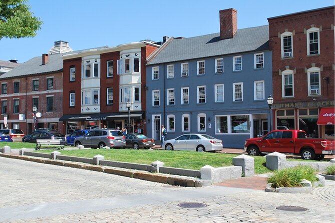
At the Brown Street stop, look for the Wadsworth Longfellow House, set slightly back from the road near the Maine Historical Society headquarters. This brick house was built after the Revolutionary War by Peleg Wadsworth, a Revolutionary War general and Henry Wadsworth Longfellow’s grandfather.
It is described as Portland’s oldest brick house. The appeal here is personal rather than monumental. You are looking at the home where one of America’s best-known poets grew up, while also seeing the kind of substantial brick construction that helped Portland recover from its fires.
The audio tells you where to look, but you still need to watch the street carefully. Some stops are easier to identify than others, especially if you are driving alone. A passenger can help locate buildings while the driver concentrates on traffic.
More Smartphone Audio Tours in the USA
- Self-Guided GPS Audio E-Bike Tour Hawaii Volcanoes National Park
★ 4.5 · 131 reviews - Santa Fe Historic Downtown Smart Phone Audio App Self Guided GPS Walking Tour
★ 4.5 · 112 reviews - Birmingham Civil Rights Walk of Freedom Smartphone Audio App Tour
★ 5.0 · 40 reviews - Self Guided GPS Audio Driving Tour Acadia NP From Hulls Cove VC
★ 4.0 · 25 reviews
Temple Street and Portland’s civic center
Temple Street brings you to the First Parish Unitarian Universalist Church, identified as Portland’s oldest church. The present building is the second structure to house the congregation.
A short distance later, the route points out Portland City Hall. This is the third City Hall on the site because the first two buildings were destroyed by fire. That repeated rebuilding is a theme of the tour, and it helps explain why Portland has so much brick architecture and so many layers of old and new construction.
These stops are brief, about five minutes each in the listed schedule. You are not being asked to tour every building from the inside. Instead, you get a quick explanation while seeing how churches, government buildings, and commercial streets fit together.
Franklin Street reveals the city’s tallest building and oldest cemetery

Franklin Street offers two very different sights. First comes Franklin Tower, a 16-story brick and concrete building built in the 1970s. It is identified as the tallest building in Maine.
Then the route turns toward Eastern Cemetery, the oldest cemetery in Portland. Some headstones date to 1768. The oldest markers were wooden and disappeared in city fires, so the cemetery also connects to the recurring story of loss and rebuilding.
This section is worth taking slowly. Cemeteries and older streets can be easy to overlook from a moving car, and the audio helps you notice them. Still, you should not stop in a way that blocks traffic. If you want a closer look, pause the tour and find a legal parking spot before walking.
The route also looks back to the 1800s, when ships entering Portland Harbor could not be seen from the docks until rounding Spring Point Ledge. That detail gives the shoreline a practical purpose. The harbor was not simply scenery. A ship’s arrival could affect trade, supplies, and the fortunes of the city.
Waterville Street shows Portland’s working-class housing
On Waterville Street, watch for the flattop triple-deckers. This New England tenement style was common from the 1880s through the 1920s.
These houses are useful reminders that Portland’s old neighborhoods were built for ordinary residents, not only wealthy merchants or famous families. Their compact design reflects the city’s growth and the need to house workers close to jobs and the waterfront.
This is one of the better sections for noticing the city at street level. You see residential architecture rather than a string of major attractions. If you enjoy houses, older neighborhoods, and the small details of urban design, keep your eyes open here.
The tradeoff is that you may need to rely on the audio to know exactly what to look for. One useful improvement would be more precise left and right directions at certain stops. Keep the map visible for occasional confirmation.
Munjoy Street opens onto Casco Bay

Munjoy Street brings the harbor into view again. You see Portland Harbor, part of Casco Bay on the southern coast of the Gulf of Maine, and the port area within it. Looking over your right shoulder, you can see South Portland and its oil tanks across the water.
The view is one of the strongest reasons to take this route by car. You cover more ground than you would on a short downtown walk and get a better sense of how Portland faces the bay.
The Eastern Promenade follows. This broad public space is where Portland residents go for sea breezes and open views. At the foot of the promenade is East End Beach.
The route does not focus on an isolated or remote beach. If your main goal is sand and swimming, this tour may leave you wanting more. If your goal is to understand Portland’s relationship with the water, the Eastern Promenade is a useful stop.
You can pause here for photos or a break. That is one of the best features of a self-guided route. The audio does not force you to move along at a fixed time.
Walnut Street recalls Fort Allen and Portland’s defenses
On Walnut Street, the tour explains how British forces destroyed the city in 1775. Portland’s leaders later decided that a fort was needed, and the green space you see is connected to that decision.
The route also returns to the old street names: Fore Street, Middle Street, and Back Street. Their names reflect their position relative to the water. This is a small detail, but it helps you read Portland’s older street plan.
The drive then crosses the Casco Bay Bridge into South Portland. The bridge links the two cities and changes the view from downtown streets to a wider look across the bay.
This crossing is a good example of the tour’s broad reach. You are not just circling Portland’s central blocks. You are following the connections among the port, nearby neighborhoods, and the communities across the water.
Meetinghouse Hill and the final approach to Fort Williams
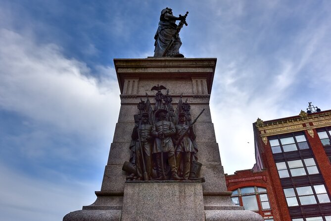
In South Portland, the route approaches Meetinghouse Hill. The setting is described as a classic New England scene: a cemetery on the left, a Civil War statue on the right, and a church behind it.
This stop is more about composition and atmosphere than a single major attraction. You can see how a cemetery, memorial, and church form a traditional civic center. The audio gives the scene context that a quick drive would not provide.
The final major section enters Fort Williams Park. You will notice military installations in the park, and the tour ends back at the original meeting point after the route is complete.
The supplied route details do not promise admission to any attractions, and entry fees or reservations are not included. Plan to treat the tour as a driving and orientation experience. If you choose to visit a museum, mansion, or other attraction, check its opening hours separately.
How the app works in real conditions
The best setup is simple but important. Download the tour while you have strong Wi-Fi or cellular service, enter the password from the email or text message, and test the audio before driving. The app is separate from the booking process, so do not wait until you are already at the pier.
The GPS normally starts each story when you reach the correct point. If there is more than one version, choose the one that matches your starting point and direction. No guide meets you at the start.
The system has handled wrong turns successfully, but it is not a full replacement for common sense or a live navigation app. Road closures and construction have caused problems, and the tour may not always bring you back to the route automatically. Keep a phone map available for emergencies, and do not attempt to operate the phone while driving.
The tour can also work well at night or in poor weather, but visibility changes what you can see. A cold November day, rain, or snow may make a car tour much more comfortable than walking. On the other hand, daylight gives you a better chance to spot houses, cemeteries, harbor views, and architectural details.
Price, timing, and who gets the best value
At $16.99 for up to four people, the math is favorable. A full car pays less than $4.25 per person, and a couple still pays less than many traditional guided options. You also avoid a fixed departure time and can pause as often as you like.
The one to two hour estimate covers the route itself. Add time for photographs, food, museums, East End Beach, or Fort Williams Park. You can finish in one sitting or spread it across several days because access does not expire.
This tour fits you best if you:
- Have a rental car or your own vehicle
- Want city history without joining a bus
- Prefer setting your own pace
- Are visiting with family or friends and want to share one purchase
- Need a weather-friendly alternative to a walking tour
- Enjoy architecture, local politics, harbor geography, and residential neighborhoods
It is less suitable if you want a human guide who can answer questions on the spot, if you dislike driving in unfamiliar streets, or if you need exact rerouting around construction. A passenger who can watch for landmarks will make the experience easier.
Should you book the Portland driving tour?
I would book it if you have a car and want a low-cost introduction to Portland that reaches beyond the downtown core. The strongest parts are the flexible pacing, the harbor and Eastern Promenade views, and the steady stream of details about fires, Prohibition, architecture, writers, cemeteries, and local neighborhoods.
I would not book it as your only Portland activity. Use it as an orientation drive, then choose one or two places to visit on foot. Download it early, start at the correct point, drive in daylight if possible, and allow extra time for road conditions.
For a family, couple, or small group sharing a car, this is a practical way to see a lot of Portland without paying per person. Just remember that the GPS is a helpful guide, not an infallible chauffeur.
FAQ
How long does the Portland self-guided driving tour take?
The route takes about one to two hours to complete, depending on your driving speed, pauses, photographs, and side visits.
How long is the driving route?
The tour covers more than 12 miles and includes over 33 audio stories.
What does the tour cost?
The price is $16.99 per group of up to four people, making it a per-car purchase rather than a per-person ticket.
Is the tour available in languages besides English?
No. The tour is offered in English.
Where does the tour start and finish?
It starts at the Portland, Maine Information Center at Ocean Gateway Pier, 14 Ocean Gateway, Portland, Maine. The route ends back at the meeting point.
Do I need cellular service during the tour?
You need strong Wi-Fi or cellular service to download the tour before starting. After downloading, the audio and maps work offline.
Does a guide meet me at the starting point?
No. This is a private, self-guided activity. You open the Action Tour Guide app at the starting point, and the audio begins when you reach the first story location.
Are attraction tickets or reservations included?
No. Entry tickets, attraction passes, and reservations are not included in the tour price.
Can I pause the tour or use it again later?
Yes. You can pause the tour, take breaks, skip stories, and return to it later. The tour has lifetime access with no expiry date.
What is the cancellation policy?
You can cancel at least 24 hours before the scheduled start time for a full refund. Cancellations or changes made within 24 hours are not refundable.
More Driving Audio Tours in the USA
- Ultimate Lake Tahoe Self-Guided Driving Audio Tour
★ 4.5 · 435 reviews - Scenic Newport, RI Self-Guided Driving Audio Tour
★ 4.5 · 325 reviews - Arches National Park Self-Guided Driving Audio Tour
★ 4.5 · 288 reviews - Kauai Adventure Bundle: 4 Epic Audio Driving Tours
★ 4.5 · 211 reviews
New audio tours around the USA
- Beaches, Bites and Bavaria in Leavenworth: A Self-Guided Audio Tour★ 3.5 · 3 reviews
- Welcome to Fabulous Las Vegas Sign Self-Guided Audio Tour★ 5.0 · 2 reviews
- Hoover Dam and Lake Mead Self-Guided Audio Tour★ 5.0 · 3 reviews
- Las Vegas Day Trips: 3-Day Self-Guided Audio Tour★ 5.0 · 2 reviews
- Driving Lake Tahoe: A Self-Guided Audio Tour From Tahoe City to Incline Village★ 5.0 · 10 reviews
- Las Vegas Neon and Secrets: Self-Guided Audio Tour★ 5.0 · 3 reviews
- Baton Rouge Historic Downtown Self-Guided Audio Walking Tour★ 4.0 · 19 reviews
- Ultimate La Jolla Self-Guided Driving & Walking Audio Tour Bundle★ 3.5 · 9 reviews
USA Audio Tours, compared.

Los Angeles: Hop-On Hop-Off Bus Tour with Audio Guide
Read our review →
City Sightseeing Hop-On Hop-Off Bus Tour with Audio Guide
Read our review →
Medieval Torture Museum Ticket with Audio Guide and Ghost Hunting
Read our review →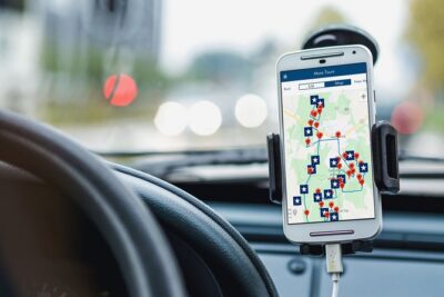

San Francisco: Alcatraz, Ferry & Audio Tour w/ Night Option
Read our review →
Ultimate Acadia National Park Self-Guided Driving Audio Tour
Read our review →
Browse the lists this tour appears in